The group of 45 participants from Kuala Lumpur boarded the Air Asia planes excitedly on Friday morning, 22 October 2010 en route to Kota Kinabalu to participate in the mother-of-all climbathons in Malaysia - Mt KK Climbathon 2010. After months of training in running up Gunung Nuang and Batu Caves and also other road races, the day of reckoning is almost imminent.
Please click here to view photos by courtesy of SCHonline.
.

Click here for Album 1 (Arrival on Friday 22 October 2010 and Start of Race on Saturday.
Click here for Album 2 (Men's Veteran and Women's Category Runners Finishing on Saturday 23 October 2010)
Stay tuned for more photos ... Do click here for other photos from SCHonline..

Friday 22 October 2010, 4:00 p.m. at Kinabalu National Park for bulk collection of bibs and race entry packs for the 45 participants. Process re-engineering is required to speed up the turnaround time. Our group is seen slowing down the other individual collection who are lined-up behind us. Tony (left), Edwin Goh, KC Leong, Yee Choi, Jason Thiang.
.
.
 Weng (left), Chong YF, yours truly (KC) and Tony Q with the Mount Kinabalu Climbathon 2010 bags
 Saturday 23 October 2010, 5:00 a.m. waiting at the hotel (about 5km from the entrance of Kinabalu National Park) for the van transport to take us to the starting point.
Yours truly (KC) is 5th from right.
 Good turnouts ... according to the organizer, this year’s participants way surpassed last year’s number – a good sign that more are taking up the challenge. The starting point is about 1km uphill run to the Timpohon Gate (Summit Trail).
 Yours truly (KC) and Mak (partly hidden, in black)
 Catherine and another strong lady runner in purple top
 Crossing the finishing line in jubilation! BRAVO !
 Yeah! We made it !!! Women’s top runners.
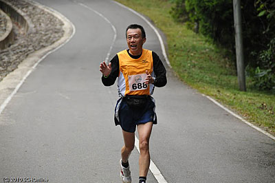
 Approaching the finishing line
 Jayne Aw (right) and Lim PY returning to the finishing line
 Edwin Goh – one of the 45 participants from Kuala Lumpur group. He made it to Lows’s peak within the 3.5 hours of qualifying time.

Crossing the finishing line in style – Jason Thiang (left), Jason Lee, Sharon Tan, ChooTS and Tony Q

Peaceful environment with lots of shades at the finishing line.
 Yee Choi made it again to Low’s Peak 10 minutes before the 3.5 hours of qualifying time. BRAVO !!!
 Your truly (KC; in the middle) posing with Yee Choi and Edwin Goh. Out of the few hundreds of participants for Men's Veteran category, only 50 made it to Low's Peak within 3.5 hours of qualifying time.
 Futuristic runner -- Aki Niaki from Indonesia talking with TonyQ. Aki Niaki is now training at Mt. Tangkuban Perahu, Indonesia.
 Peter Chan, TonyQ, Sharon Tan, Weng
 Good turnouts ... according to the organizer, this year’s participants way surpassed last year’s number – a good sign that more are taking up the challenge. The starting point is about 1km uphill run to the Timpohon Gate (Summit Trail).
 Yours truly (KC) and Mak (partly hidden, in black)
 Catherine and another strong lady runner in purple top
 Crossing the finishing line in jubilation! BRAVO !
 Yeah! We made it !!! Women’s top runners.
 Approaching the finishing line
 Jayne Aw (right) and Lim PY returning to the finishing line
 Edwin Goh – one of the 45 participants from Kuala Lumpur group. He made it to Lows’s peak within the 3.5 hours of qualifying time.
Crossing the finishing line in style – Jason Thiang (left), Jason Lee, Sharon Tan, ChooTS and Tony Q

Peaceful environment with lots of shades at the finishing line.
 Yee Choi made it again to Low’s Peak 10 minutes before the 3.5 hours of qualifying time. BRAVO !!!
 Your truly (KC; in the middle) posing with Yee Choi and Edwin Goh. Out of the few hundreds of participants for Men's Veteran category, only 50 made it to Low's Peak within 3.5 hours of qualifying time.
 Futuristic runner -- Aki Niaki from Indonesia talking with TonyQ. Aki Niaki is now training at Mt. Tangkuban Perahu, Indonesia.
 Peter Chan, TonyQ, Sharon Tan, Weng
Stay tuned for more photos ... Day2 Men's Open category
.
.
Other photos from SCHonline ... click here.
.
Click here for all previous postings relating to Mt KK Climbathon 2010. (This posting is included also; do scroll down the web pages; at end, click Older Posts for more ... ).
Posted by KC
.


