Sunday, August 28, 2016

Kota Damansara Trail Run

Trail running at Kota Damansara on Saturday morning, 27 Aug 2016 with running friends and Elsie's good-looking and adorable Roxie, a female Rottweiler ... Round trip (from Seksyen 9 to Seksyen 10 and return) was 4 hours; according to George Siew's timing device, we ran a total of 14km. 

We were trying out some shortcuts and ended up heading to nowhere, and have to backtrack for almost 500 meters. From the post-event trail map, we realised that the shortcut is the loop for Sahabat trail but we went off tangent. 

Do click here to view photos taken by yours truly.

 This pondok is the demarcation for Harmoni trail (at Seksyen 9 end, left of photo frame), and Unity trail (at Seksyen 10 KDCF end, right of photo frame)
 Elsie and her adorable Roxie
 At the Denai Tiga Putri peak
(left, behind) David Ong, George Siew, ChongYF, Eric Wong, KC Leong
(front) Josephine, Elsie Liew, Lana ... and of course the star, Roxie
 Additional challenge for the doggie to go up the ladder
 There is a giant tree along the trail to the peak
Arriving at the pond of Kota Damansara Cummunity Forest in Seksyen 10; from here, we have to run back to the other end where we parked our cars

Do click here for the trail and location map drawn by yours truly.

Posted by KC Leong


Monday, August 22, 2016

The Cutting Edge Campout 3.0

Participating in the Cutting Edge Campout 3.0 at Kem Sungai Pauh from 19-21 August 2016 ... Cutting Edge forums (in Facebook) share and exchange information on knives, cool gear and the great outdoors.

This campout event was organized by Marcus Wong and assisted by Li Kuan, Kevin Lee, Chew Soon and Ken. It was a well organized event with lots of food, camaraderie and laughter amid the cool mountains of Cameron Highlands. The event ended with a lucky draw having a few razor-edged knives as prizes.

Do CLICK HERE to view photos courtesy of yours truly (KC Leong).
Sungai Pauh campsite at Cameron Highlands; it is near to Tanah Rata
The campsite is nestled in between tall trees
This is where I pitch my tent
My camping stuff just next to the Kelty Salida 1-man tent
Pat (left) is cooking a delicious fish-head curry while Marcus, the organizer of the event, looks on
Another group of students doing some serious cooking ... notice that there is electricity plug point at the left pillar
A pleasant and conducive environment for camping
Setting up of hammocks is possible since the tress are close to one another. However, one must have a good sleeping bag as the temperature in the wee hours drop to 15 degrees Celsius (which is very cold).
Another two camping sections at the upper tier. This area is a little further away especially going to the toilet at night though the entire campsite is lighted up at night
A big flysheet serving as a communal area for chill out. It has been drizzling on Day1 and Day2 at this campsite so the flysheet is a must
Day2 BBQ dinner - Marcus busy grilling drumsticks and hot dogs assisted by Kelvin and Ken
Jimmy and Chew Soon examining the the various types of knives
Some of the participants in this Cutting Edge v3 campout
Lucky draw - Wilson Ng receiving the gift from Marcus; on the right is Ken

Posted by KC Leong

Tuesday, August 16, 2016

A Challenging Ride to Bentong

“When was the last time that you ride your road bike?” Sri Ganesh, the team lead asked me when we met at the rendezvous point while preparing to start off our riding journey from an orang asli settlement somewhere along the old Gombak road on Sunday 14 Aug 2016 at 7 a.m.

“RHB LEKAS Highway Ride in the 78km category on 30 April 2016,” I replied. And that was 3.5 months ago!

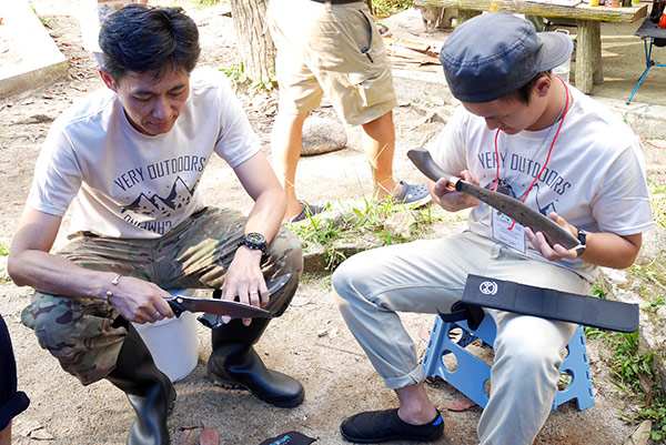
Together with a few RHB Bank colleagues (Philip Wong, Mike Koh, Paul Yap, Chi Yean) and Team NATO cycling group (CK, Lai, etc), I followed the group without knowing where we were going. They are serious cyclists, and that has to be an endurance ride. Since I bought a new Giant bike for the RHB LEKAS ride, I should be OK. That was the first time – after many years – that I followed a group for long distance ride. Most of the time, I was doing trail running and trekking.

A group photo at the mobile drinks station ... Mike (L1), Philip (L2); KC (R1), Paul (R2), Ganesh (R3), Chi Yen (front) ... photo credit Paul Yap; clicking on the photo would display much bigger picture

The Journey 

We were heading towards Genting Sempah R & R (rest and relaxation area) via the old road. This section of the terrain was gradually going uphill all the time. There was very little traffic as the road is narrow and winding, constructed by the side of the mountains with cliff on the opposite end. Certain parts of the road shoulders are wide, but the irresponsible people dumped and burned rubbish there.

Just before arriving at Genting Sempah, there were a few downhill sharp bends, merging with the same traffic where one is coming down from Genting Highlands. Just before the downhill section under a flyover, there was a mobile drinks station doing good business with the bikers who need to replenish their drinks.

After Genting Sempah, it was going downhill all the way until one passed by the junction to Bukit Tinggi (on the left) and Janda Baik kampong (on the right). Certain stretches of the road surface were really rough, and they were long overdue for resurfacing. It sure was a bumpy ride hitting the groan area by the saddle without any shock absorber.

At one downhill sharp bend towards the right, after going into the bend, then only I realised that the road was strewn with sand. Gaining momentum with the downhill, it was a tricky moment as too much steering towards the right side would cause the bike to skid and fall. With a split-second glance to examine the road shoulder, I decided not to continue the steer but went off on a tangent into shrubs and stopped. Luckily, I pulled through without any mishap. Any cornering scattered with sand or cylinder oil would be extremely dangerous that can cause bikers to skid and sustain nasty fall. 
(photo credit: Sri Ganesh)

At Bentong Town

It was a different experience arriving at the market area. One month ago, I was leading a trail running and trekking group for scaling to the peak of Gunung Rajah and we were having our breakfast at Hooi Kee Wan Ton Noodles coffee shop. We came by cars then. At 10 a.m. on Sunday morning, the coffee shop was packed to the brim; so was the entire market area bustling with activities. We have to settle with another coffee shop with lesser people. 

While eating, we were told by the locals that the ais kacang stall which is just down the road (same row as Hooi Kee coffee shop) was better than the Kow Po coffee shop which is famous with ais kacang or chendol topped with ice cream. When I walked to this new discovery, it was packed with locals enjoying the dessert.
(photo credit: Sri Ganesh)

The Returning Journey

The interesting part of cycling is that cyclists always look for hilly terrains for the challenge -- riding on flat road is deemed unexciting. Recognizing that we crossed the mountainous areas, the returning journey with the tired bodies would be tougher in going up the same mountain, from the opposite end. 

Overall it was a fun, challenging, yet tiring and risky journey considering that we have three riders fell on the road that sustained bruises, and two tyres were punctured.

Fact Sheet (courtesy of Sri Ganesh)

Total distance: 108.6km
Moving time: 5 hr 17 min (total time spent was 8 hours)
Elevation gain: 3,609 meters


Posted by KC Leong

Saturday, August 06, 2016

Sg Lembing and Cherating Holidays

Holidaying at Sungai Lembing from 29 July 2016 for 3D2N and then adjourned to Cherating beach for another night of stay.... At Sungai Lembing, the Rainbow waterfall and the Panorama Hill (to see sunrise and sea of clouds) attract many holidaymakers. This small town is flourishing with tourists related business. At the market area for breakfast, it was crowded with people. 

To go to the Rainbow waterfall, one needs to engage a 4WD that can carry 14 persons maximum. The 4WD journey is 1 hour while the trekking journey requires another 30 - 45 minutes. 

To go to the Panorama Hill to view sunrise, the trail head is only 500 meters from the market. The trail is completed with 1,000 concrete steps. Going up the hill requires 30 to 45 min.

At Teluk Cempedak, the beach is very clean with the white sand. We stay another night at Cherating beach.

Round trip from Kuala Lumpur is about 900km. Overall, it was an enjoyable and memorable holiday.

Do CLICK HERE to view photos courtesy of yours truly (KC Leong).

 At Sungai Pandang waterfall en route to Sungai Lembing which is only 30 minutes away
 A group photo before going to Rainbow waterfall
 It is crowded at Rainbow waterfall even on a normal weekend
The ladies posing with the rainbow
 Nature's creation -- best time to view the rainbow is from 10 to 11 a.m. depending on the strength of sun ray and the amount of water falling from the cliff
 Free and easy at the homestay and we have BBQ dinner here 
 At Panorama Hill (second morning) to see sunrise
Background with the sea of clouds
 At around 7:30 a.m. the villages below the clouds are now visible
Arriving at Teluk Cempedak beach ... the beach is clean with the white sand
 Yeah ... Yeah ... A group of excited holidaymakers :-)
 Relaxing by the Cherating beach where we put up another night here

 From Kuantan to Kuala Lumpur ... somewhere before Benton town
The chalets (on the left of photo frame) can house 10 persons to each unit; the huts behind me are for cooking or chatting. The resort is nestled under the durian trees; beware of your heads when walking around during durian season. Or when durians fall on to the zinc rooftop at dawn, that would be the nature's morning call. There is a river behind the chalets, and a waterfall about 7km away. Good for group activities.

Posted by KC Leong